TL;DR
Google Maps API is more than just an interactive map for websites, it’s a powerful location intelligence tool that enables businesses to embed maps, calculate routes, display points of interest, and integrate geolocation features into web and mobile apps. By leveraging Google Maps API, businesses can optimize the customer experience through store locators, delivery tracking, and seamless navigation. It also enhances marketing campaigns with location-based targeting, improves logistics and operations via real-time routing and fleet management, and enables AI-driven insights by integrating maps data with analytics platforms such as GA4 and DV360. With its flexibility, scalability, and real-time data capabilities, Google Maps API has become an essential tool for both enterprises and SMBs, powering applications that range from eCommerce platforms to smart city initiatives.
Key Components of Google Maps API
Understanding the core components of Google Maps API helps businesses choose the right tools to integrate location intelligence into their applications. Each API serves a distinct purpose, enabling businesses to deliver highly interactive, data-driven, and personalized experiences.
1. Maps API
The Maps API allows businesses to embed fully interactive maps directly into websites and mobile apps. It supports advanced customization, including map styles, overlays, markers, and pop-ups, ensuring the map aligns seamlessly with your brand identity. Whether it’s a store locator for retail chains or an event map for conferences, this API provides a flexible foundation for geospatial visualization.
2. Routes API
The Routes API provides precise, real-time navigation for driving, walking, or public transit. It factors in current traffic conditions, road closures, and preferred travel modes, helping users reach their destinations efficiently. Businesses can leverage this for delivery optimization, field service management, ride-hailing apps, or last-mile logistics, enhancing both operational efficiency and customer satisfaction.
3. Places API
With the Places API, businesses can integrate location-based search and discovery into their applications. Key features include autocomplete search for location input fields, access to detailed information about businesses (reviews, photos, opening hours), and identification of points of interest. Retailers, travel platforms, and hospitality apps can deliver intuitive search experiences that guide users to the right locations effortlessly.
4. Geocoding & Geolocation APIs
The Geocoding API converts human-readable addresses into geographic coordinates, while the Reverse Geocoding API converts coordinates back into readable addresses. Combined with the Geolocation API, which tracks device locations in real time, these tools enable location-based personalization, delivery tracking, asset monitoring, and emergency response applications.
5. Distance Matrix API
The Distance Matrix API calculates travel times and distances between multiple origins and destinations. Businesses can use it to optimize delivery routes, estimate arrival times for services, or analyze network efficiency for logistics and transportation. This API is crucial for improving operational planning and reducing costs in complex route networks.
6. Street View API
The Street View API provides immersive 360° panoramic imagery, allowing users to virtually explore streets, buildings, and landmarks. This is particularly valuable for real estate platforms, tourism apps, and retail locations, offering an interactive experience that drives engagement and helps users make informed decisions.
7. Time Zone & Elevation APIs
The Time Zone API provides accurate global time zone conversions, while the Elevation API delivers precise elevation data for any location. These APIs support logistics planning, outdoor adventure apps, travel itineraries, and any application requiring geospatial intelligence beyond basic maps.
With the right mix of Google Maps APIs, businesses can transform simple maps into intelligent location-based solutions that drive both user satisfaction and operational excellence.
Why Businesses Use Google Maps API
Google Maps API has evolved from a simple mapping tool into a mission-critical business asset, helping enterprises and SMBs leverage location intelligence to improve operations, user experience, and marketing effectiveness. Its applications span across industries:
-
Retail & eCommerce:
Enable customers to find nearby stores, check product availability in real time, and access click-and-collect or curbside pickup options. Interactive maps enhance shopping journeys and reduce friction in the buying process.
-
Logistics & Transportation:
Optimize fleet management, calculate the fastest routes, predict delivery times, and minimize fuel costs. Real-time traffic updates help logistics companies improve operational efficiency and customer satisfaction.
-
Travel & Hospitality:
Offer immersive trip planning experiences, highlight nearby attractions, and provide hotel or restaurant proximity insights. Maps and Street View integration help travelers make informed decisions instantly.
-
Healthcare:
Allow patients to locate clinics, hospitals, or pharmacies efficiently. Geolocation services ensure timely access to medical facilities and improve patient engagement.
-
Marketing & Advertising:
Drive location-based campaigns, geofencing strategies, and footfall analysis. Businesses can deliver hyper-targeted promotions and track campaign effectiveness using location data.
-
Real Estate:
Showcase property locations with interactive maps and Street View integration, providing potential buyers and renters with an immersive virtual tour experience before visiting.
By incorporating Google Maps API, businesses transform raw location data into actionable intelligence, enabling smarter operational decisions, enhanced customer satisfaction, and measurable ROI.
You May Also Like to Read 👉 Which Mapping Platform Is Best in 2025?
Benefits of Google Maps API
Leveraging Google Maps API provides businesses with a suite of tangible advantages that go beyond simple navigation:
-
Accuracy & Reliability:
Real-time updates ensure that maps, routes, and points of interest are always current, reducing errors and enhancing trust.
-
Scalability:
Handle millions of API calls seamlessly without performance degradation, making it suitable for global enterprises and high-traffic applications.
-
Enhanced User Experience:
A familiar Google Maps interface builds trust, encourages engagement, and simplifies navigation for end-users.
-
Customization:
Businesses can tailor map styles, markers, overlays, and info windows to match brand identity, creating a cohesive and professional experience.
-
Data-Driven Insights:
Integration with platforms like GA4 and DV360 allows businesses to analyze geospatial data for marketing, operational planning, and AI-driven personalization.
-
Cross-Platform Integration:
Google Maps API works consistently across web applications, Android, iOS, and enterprise software, ensuring seamless multi-device experiences.
-
Operational Efficiency:
By optimizing routes, managing assets, and predicting demand, companies can save time and resources while delivering better customer outcomes.
In essence, Google Maps API empowers businesses to connect the digital and physical worlds, creating smarter, faster, and more engaging experiences for customers while driving measurable business growth.
Google Maps API Pricing
Google Maps Platform operates on a flexible pay-as-you-go model, making it accessible for startups, SMBs, and large enterprises alike.
-
Free Tier:
Every account receives a $200 monthly credit, ideal for small-scale apps, testing environments, or initial proof-of-concept projects. This allows businesses to explore Maps, Routes, and Places APIs without upfront costs.
-
Paid Plans:
Charges are usage-based and vary according to API consumption, including Maps, Routes, Places, Distance Matrix, and other specialized APIs. This ensures scalability—your costs grow only as your usage grows.
-
Budget Control:
Google Cloud provides configurable usage limits, alerts, and billing dashboards to prevent unexpected overages. Businesses can monitor API consumption in real-time and optimize workflows to stay within budget.
Pro Tip: Use Google’s Pricing Calculator to estimate monthly API costs accurately. Planning ahead allows you to forecast budgets, evaluate ROI, and prioritize high-impact applications.
How to Implement Google Maps API
Integrating Google Maps API into web or mobile applications is straightforward if approached systematically:
-
Create a Google Cloud Project:
Start by setting up a project in the Google Cloud Console and enable billing.
-
Enable Required APIs:
Depending on your needs, enable APIs such as Maps, Routes, Places, Geocoding, Distance Matrix, and Street View.
-
Generate an API Key:
Configure your API key with proper usage restrictions (HTTP referrers, IP addresses, or app restrictions) to enhance security.
-
Add SDKs or Libraries:
Incorporate the Google Maps SDK for Web, Android, or iOS platforms based on your application environment.
-
Test and Monitor:
Verify your implementation using the Google Cloud Console, Debugger tools, and real-world tests.
-
Advanced Integration:
For businesses seeking deeper insights, APIs can be integrated with analytics platforms like GA4 or DV360, combining geospatial data with behavioral analytics for AI-driven personalization, marketing optimization, and operational efficiency.
How to Pull Data with Google Maps API
One of the most powerful features of the Google Maps API is the ability to extract and use location-based data within your applications. By leveraging the Maps Platform, developers can retrieve detailed information about specific locations, including full addresses, latitude and longitude coordinates, nearby points of interest (POIs), business details, and even real-time traffic data. This capability forms the backbone of location intelligence applications, enabling everything from mapping services and geolocation apps to logistics management and location-driven marketing campaigns.
For instance, a retail app can dynamically display store locations near a user, a travel app can provide nearby attractions, and a delivery platform can optimize routes in real time all by pulling and processing data from the Google Maps API.
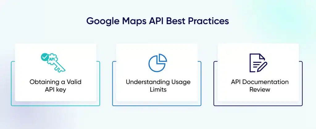
However, accessing this data requires a valid Google Maps API key, which ensures secure and authorized usage. Developers must also be mindful of usage limits and billing policies, as exceeding free-tier allocations can result in additional charges. The Google Maps API documentation provides comprehensive guidelines for quotas, pricing, and best practices for managing requests efficiently.
To pull data effectively, developers can use APIs such as Places API (for POIs and business details), Geocoding API (for converting addresses into coordinates and vice versa), and Distance Matrix API (for calculating travel distances and times). Combining these APIs allows businesses to create highly customized, data-driven experiences that leverage real-time location intelligence.
Practical Use Cases Across Industries
Google Maps API is versatile, powering location intelligence and enhancing user experience across multiple sectors:
-
Retail:
Implement store locators, show inventory by nearest location, and offer click-and-collect or curbside pickup points, improving customer convenience and conversion rates.
-
Logistics:
Optimize fleet operations with real-time tracking, dynamic route planning, and delivery ETA updates, reducing costs and increasing operational efficiency.
-
Healthcare:
Help users locate the nearest hospitals, clinics, or pharmacies and provide emergency routing, enhancing patient safety and accessibility.
-
Travel & Tourism:
Deliver interactive trip planners, local guides, and immersive Street View experiences for travelers seeking detailed, real-world context.
-
Marketing:
Enable hyper-local campaigns, geofencing promotions, footfall tracking, and location-based targeting for better ROI on digital marketing investments.
-
Real Estate:
Visualize property locations, conduct proximity analysis, and create virtual tours with Street View integration, helping buyers make informed decisions.
By leveraging Google Maps API across these industries, businesses can transform location data into actionable intelligence, streamline operations, enhance customer experience, and unlock new revenue streams.
Common Pitfalls to Avoid When Using Google Maps API
Even with a powerful tool like Google Maps API, improper implementation can lead to security risks, inefficiencies, and missed opportunities. Avoid these common mistakes:
-
Not Securing API Keys: Leaving API keys unrestricted exposes your account to misuse, resulting in unexpected charges or malicious activity. Always set HTTP referrer, IP, or app restrictions.
-
Ignoring Usage Quotas: Google Maps APIs have usage limits, and exceeding them without monitoring can lead to overage fees. Set alerts and monitor usage in the Google Cloud Console.
-
Over-Reliance on Default Map UI: Using un-customized maps may lead to a generic or confusing user experience. Customize map styles, controls, and markers to match your brand and improve engagement.
-
Lack of Integration with Analytics: Without connecting Maps API to platforms like GA4 or DV360, you miss valuable insights on user behavior, engagement, and campaign performance.
By proactively addressing these pitfalls, businesses can protect their investment, improve UX, and maximize ROI from location-based applications.
Advanced & Future Considerations
Google Maps API is evolving beyond simple maps into a full-fledged location intelligence platform. Forward-thinking businesses can leverage these innovations to stay ahead:
-
AI-Powered Maps: Predictive routing, dynamic traffic analysis, and crowd density forecasting help enterprises optimize logistics, improve delivery times, and enhance customer experience.
-
Augmented Reality (AR) Integration: Overlay directions, promotions, or product information in retail, navigation, and tourism apps, offering immersive user experiences.
-
Electric Vehicle (EV) Navigation: Real-time charging station locations, availability updates, and route optimization for EV fleets are becoming essential for sustainable logistics and urban mobility.
-
Privacy-First Maps: Compliance with regulations such as GDPR, CCPA, and DPDP ensures that location data is collected and processed securely, building user trust.
-
Conversational Interfaces: Integration with AI assistants like ChatGPT, Gemini, and Claude enables voice-based directions, predictive suggestions, and context-aware search, making maps more interactive and accessible.
In today’s digital landscape, Google Maps API is no longer just a mapping tool—it’s a strategic platform for business intelligence, operational efficiency, and customer engagement. Enterprises that adopt these advanced capabilities can transform raw geospatial data into actionable insights that drive revenue, optimize operations, and elevate the overall user experience.
Google Maps API vs Competitors
While several mapping solutions exist, Google Maps API consistently stands out due to its accuracy, scalability, and extensive ecosystem. Here’s how it compares:
-
Mapbox: Known for high customization and developer flexibility, but its points-of-interest (POI) database is smaller, which may limit real-world applications.
-
OpenStreetMap (OSM): Free and open-source, making it ideal for cost-conscious projects, but real-time traffic and route optimization are less reliable compared to Google.
-
MapMyIndia: Excellent for India-specific mapping and geospatial data, offering precise regional insights. However, it lacks the global coverage and integration ecosystem that Google Maps API provides.
Despite these alternatives, Google Maps API remains the most comprehensive, reliable, and widely adopted platform for enterprises seeking robust location intelligence, real-time routing, and AI-enabled geospatial analytics.
Conclusion: Why Google Maps API is a Strategic Growth Engine
Google Maps API is no longer just a tool for embedding maps—it has become a core driver of business growth and operational efficiency. Businesses that harness its capabilities can:
-
Enhance User Experience: Deliver intuitive navigation, predictive search, and location-based recommendations.
-
Optimize Logistics & Operations: Streamline fleet management, route optimization, and real-time delivery tracking.
-
Drive Data-Driven Marketing: Use geospatial insights to power hyper-local campaigns, audience segmentation, and footfall analysis.
-
Enable AI & Personalization: Combine Maps API data with analytics platforms like GA4 and DV360 to fuel AI-powered personalization engines, predictive services, and smart automation.
With advanced analytics and GA4 implementation in place, Tatvic’s experts specialize in setting up, validating, and scaling Google Maps API for enterprises. From reducing friction in customer journeys to transforming raw geospatial data into actionable insights, we ensure your Maps API implementation drives measurable growth and strategic advantage.
Whether you’re in retail, logistics, healthcare, travel, or real estate, Google Maps API empowers your business to connect the physical world with digital experiences, making every interaction smarter, faster, and more meaningful.